Cataraqui Trail
The Cataraqui Trail is 104 km in length from Strathcona (near Napanee) to Smith Falls. The section from Harrowsmith to Smith Falls, 80 km, is part of the Trans Canada Trail.
The Trail
In 1998 I cycled 15.5 km from Perth Road to just short of Harrowsmith. In 2000 I cycled 20 km from Perth Road to Chaffey’s Lock. Each time I reversed my direction and cycled the same distance back to my starting point.
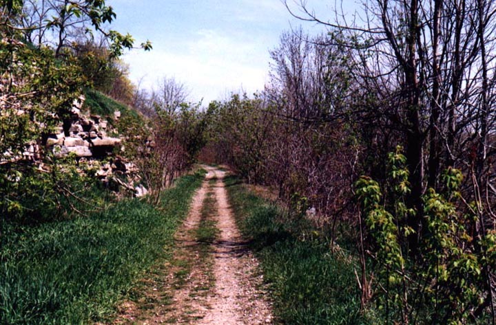
From Perth Road west to Sydenham the trail surface was quite good. There were occasional sections where the surface was a bit loose and stony, but not bad. Past Sydenham the surface deteriorated and as I approached Harrowsmith it became unrideable. I walked my bike a short distance over large, loose stones, then gave up and returned to my starting point.
East of Perth Road the surface was decent for about 1 km then poor for the next 5, including about 300 metres where I walked the bike over loose stones. The rest of the way to Chaffey’s Lock was not bad.
I think the trail is primarily maintained for snowmobile use, which does not require a smooth surface (because it is covered with snow). Some improvements have been made in the years since I was there, see the link below for the latest. The scenery is wonderful in many places with fields, lakes, swamps and rock outcrops. There is plenty of wildlife and in summer the bugs can be awful. I cycled it on a hybrid but a mountain bike would be more appropriate.
The following was contributed by Ryan McCord:
I rode the Cataraqui Trail between Smith Falls and Strathcona. As you can imagine, that much unsurfaced trail is pretty rough and tiring. The trail varies from monotonous, rough riding to incredibly scenic. For a day trip I recommend the 30 km+/- from Chaffey’s Lock to Sydenham. This is by far the most scenic - large granite hills, deep rock cuts, high embankments over lakes. There is even a tunnel, but not on the trail itself, at around km 53 or 54. It was blasted through the rock beside the trail and was used to drain a swamp, and through which a stream still flows. The main drawback is that there is about 1 km near km 55 that is too rough to ride. I would definitely recommend a mountain bike, and to avoid trying to ride on a time limit.
Trail Amenities
There are kilometre markers on some parts but nothing else. Only parking is on cross roads. There are stores in Chaffey’s Lock and Perth Road (about 1 km south of trail). Carry plenty of water and insect repellant.
Accessibility for Wheelchairs and Suitability for Children
Not suitable for wheelchairs. It is suitable for older children with suitable bikes.
History
The trail follows a former Canadian National Railway line.
How to Find
The only place I accessed the trail was from Perth Road. Perth Road starts at the north end of Kingston (you will need a map). Follow it to the community of the same name, then about another kilometre where the trail crosses the road.
Area Attractions
Kingston is a very pleasant city along its waterfront. The Rideau Canal passes through Chaffey’s Lock.
More Information
www.cataraquitrail.ca
|
